Current Works-in-Progress
Current snapshots of transit diagrams imagining a bolder future for transit in Philadelphia and the New York Region. Both are informed by various plans and proposals encouraging optimism about the future of mobility.
An optimistic look into a future Philadelphia with healthy transit investment and expansion, focusing on connecting underserved areas with a holistic buildout.
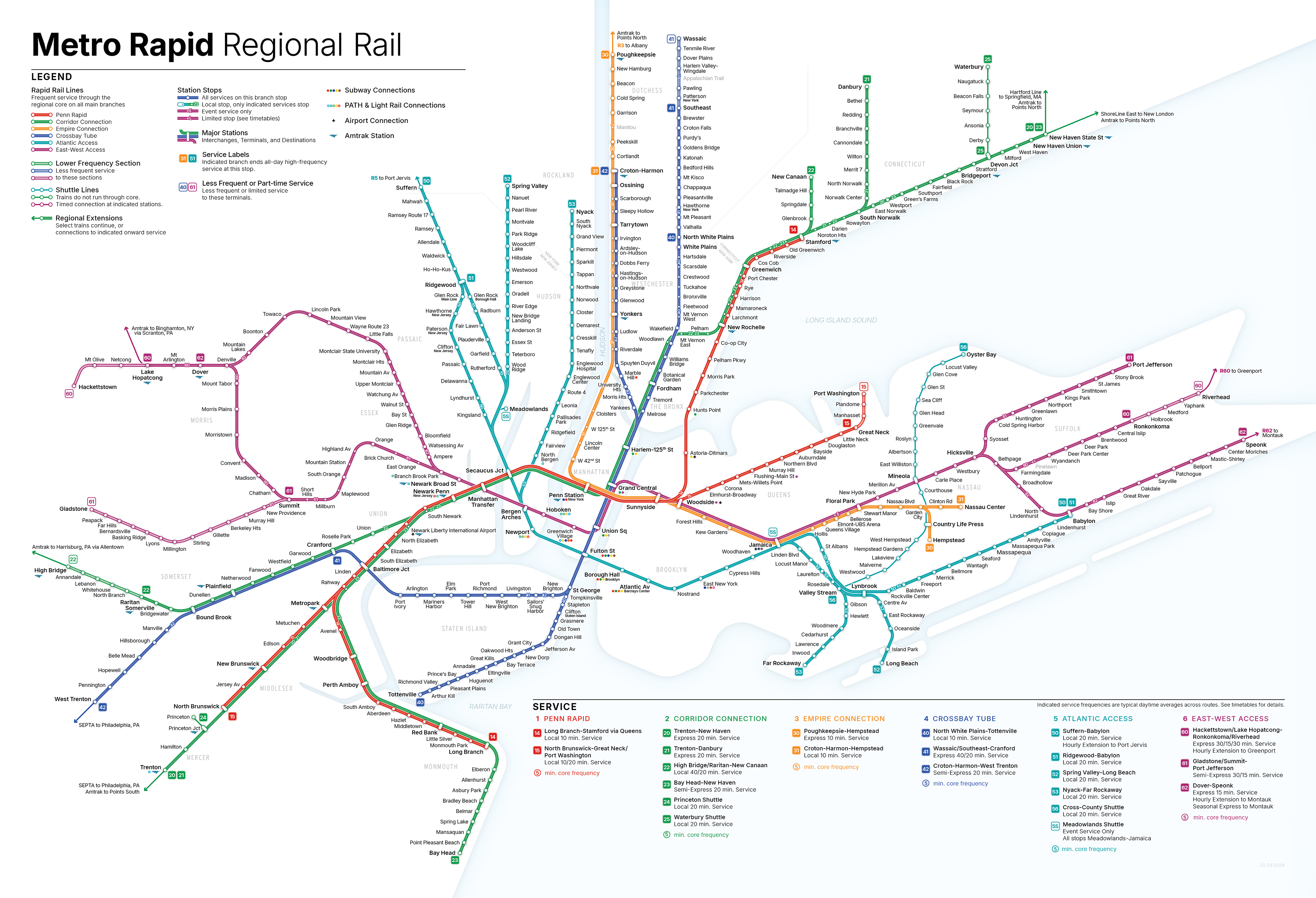
This concept is based on the thoughts of Alon Levy, a transit planner who has worked to imagine a system of through-running, frequent regional rail for the New York Region.
Engaging a Transit-skeptical Public
Developed for the public engagement portion of a suburban Georgia county's transit development plan, this diagram shows the proposed routes in simplified form. Constraining the routes to straight lines and specified angles helped simplify the network to make it more digestible, revealing a cross-county grid network among the curvy roadways.

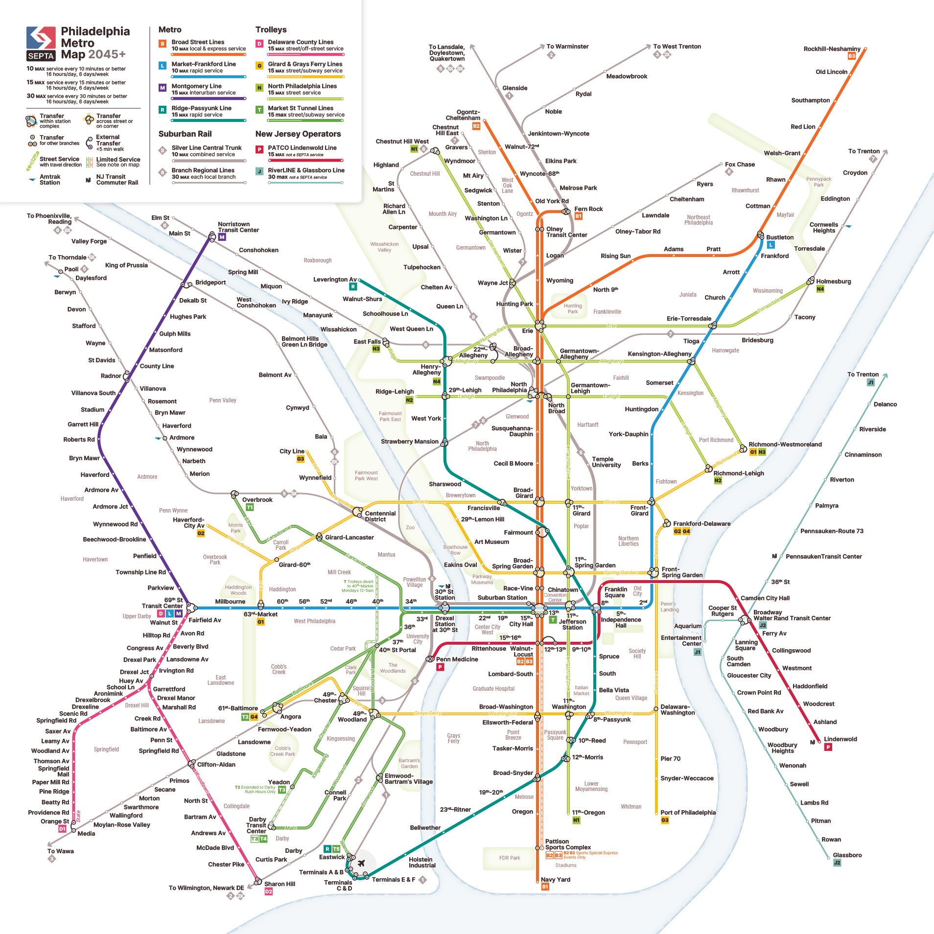
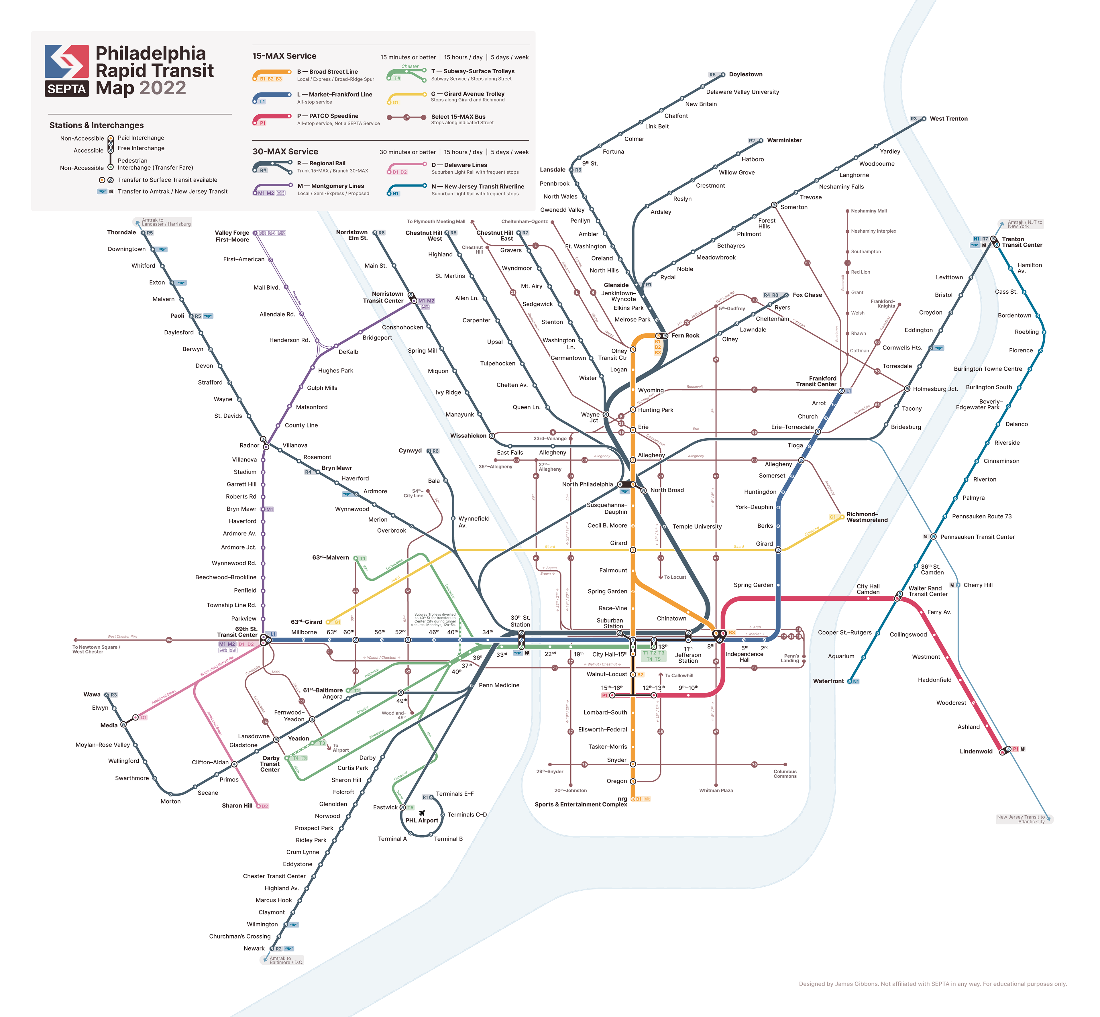
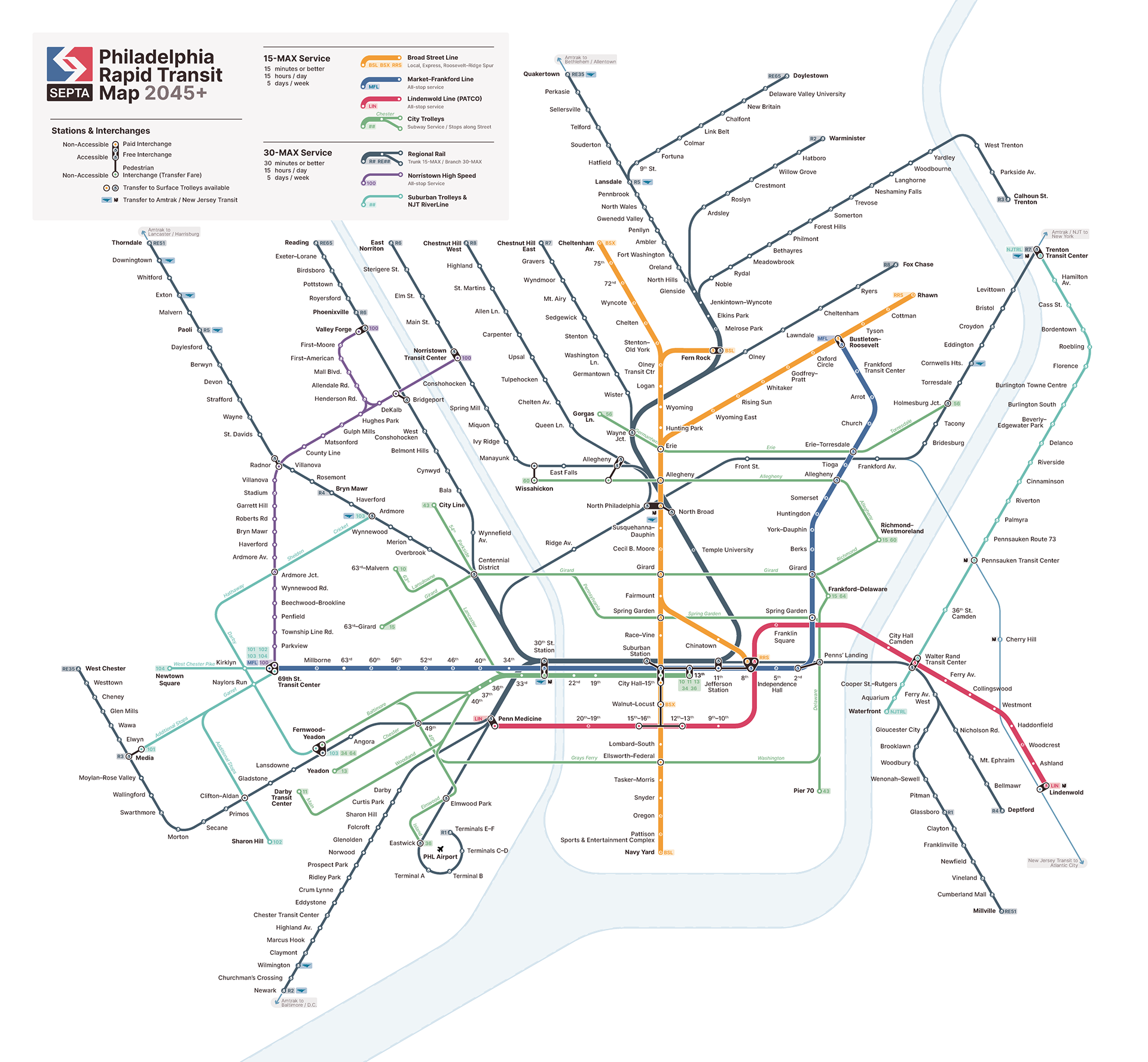
Rethinking SEPTA
Maps and wayfinding designs exploring a possible new language for Philadelphia's regional and rapid transit. 2022 System map is inspired by the changes proposed in the ongoing SEPTA Metro usability experiment.
The 2045+ map explores how former and proposed rail corridors and extensions might contribute to a more unified region. These crayoned routes are informed by regional planning reports from various sources.
As a part of imagining expanded service, I also began to explore how system wayfinding and branding might be implemented in a more unified way throughout the region.
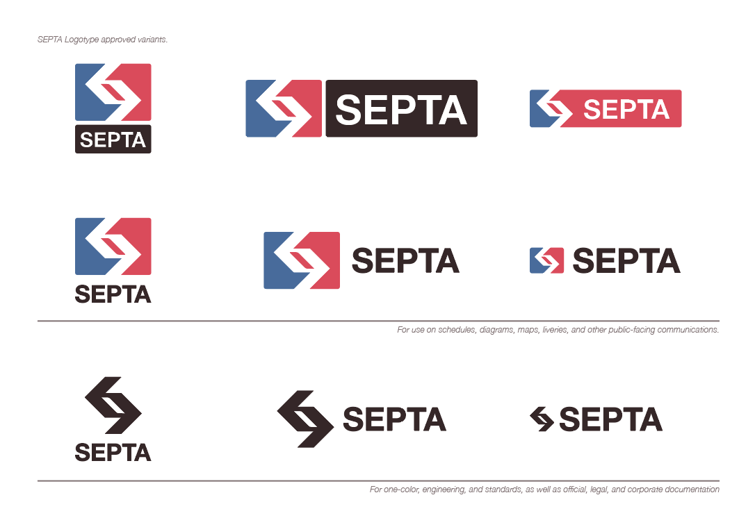
Reimagined Authority logo with simpler lines and more trustworthy posture.
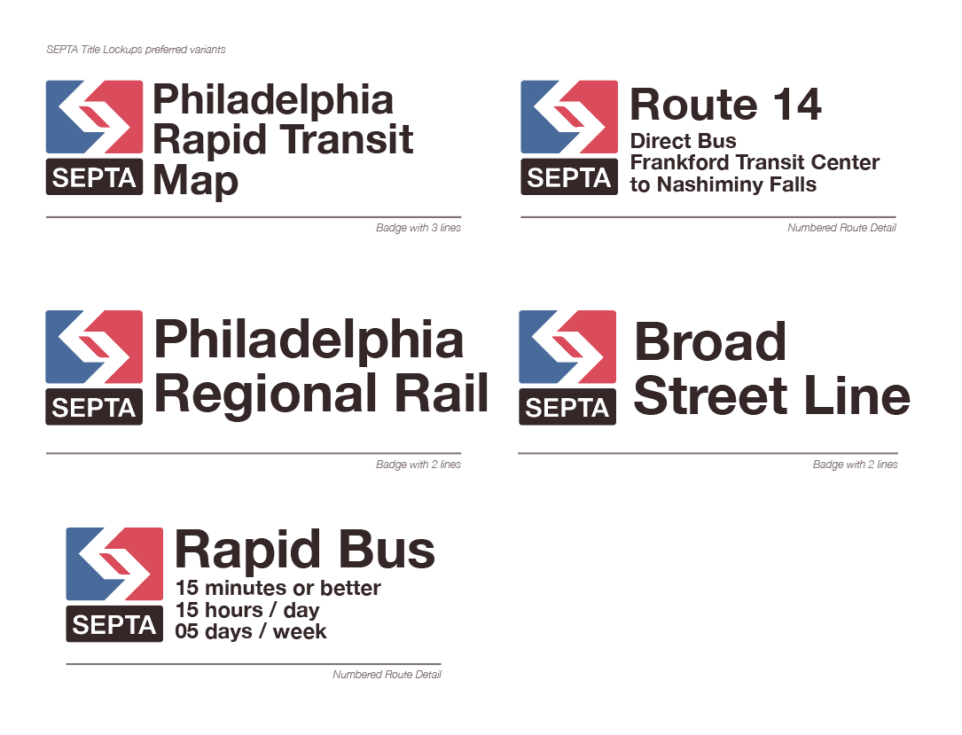
Possible lockup exploration for consistent branding throughout system use cases.
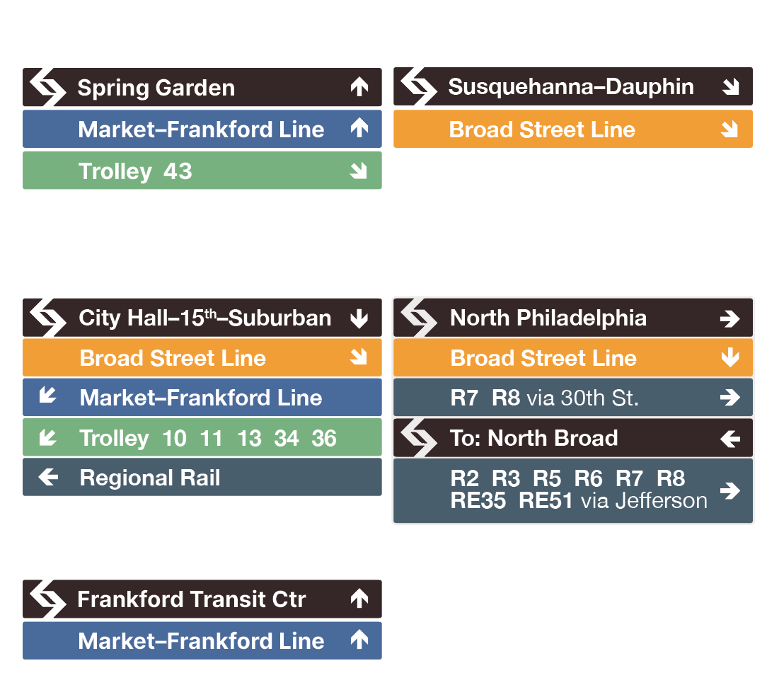
Early wayfinding signage exploration, a first step toward a more unified experience.
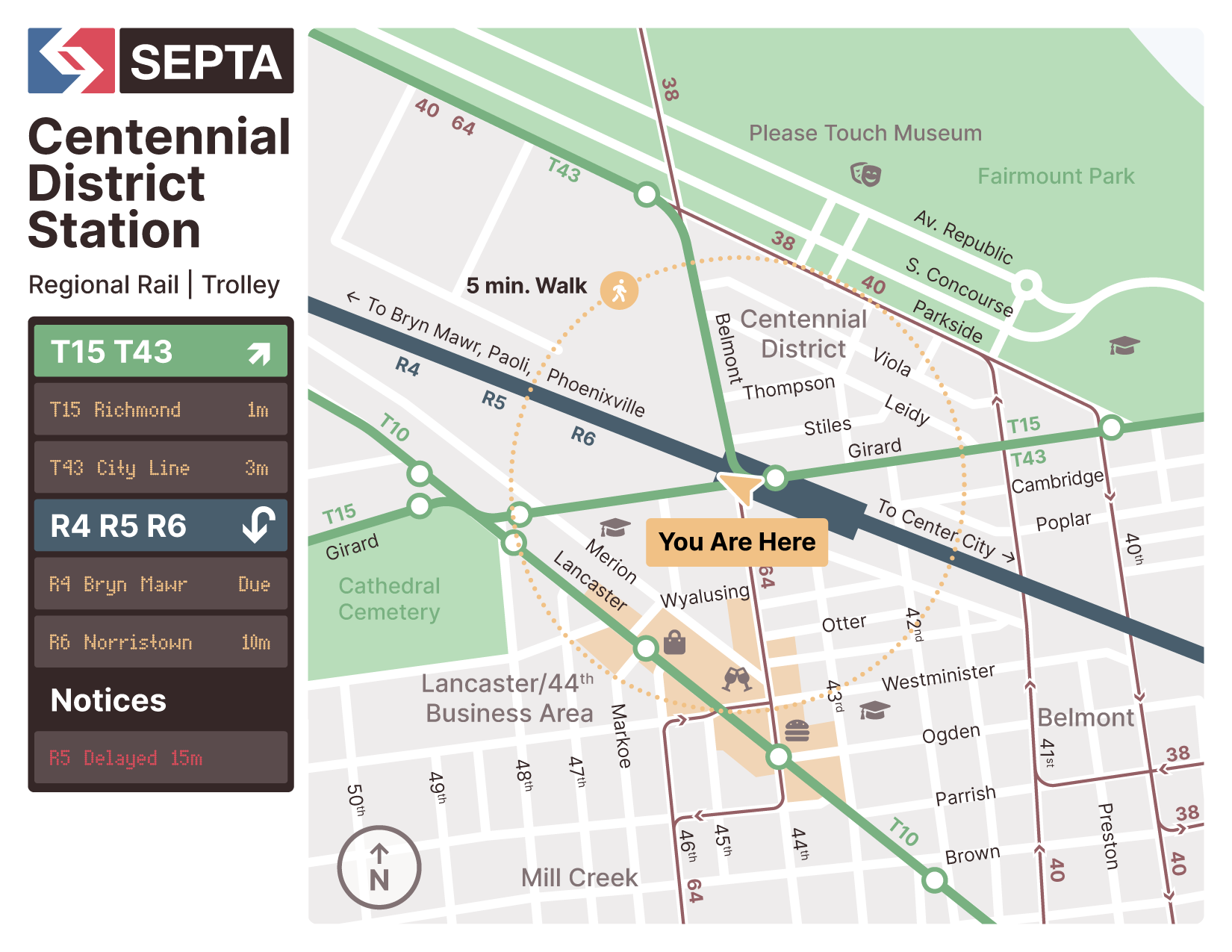
Area map and next arrivals concept
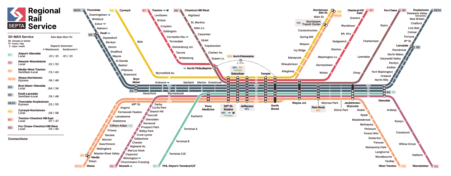
Regional Rail Stripmap concept
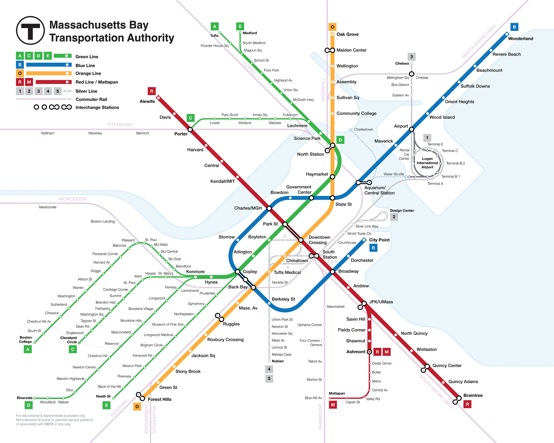
Conceptual MBTA System Map
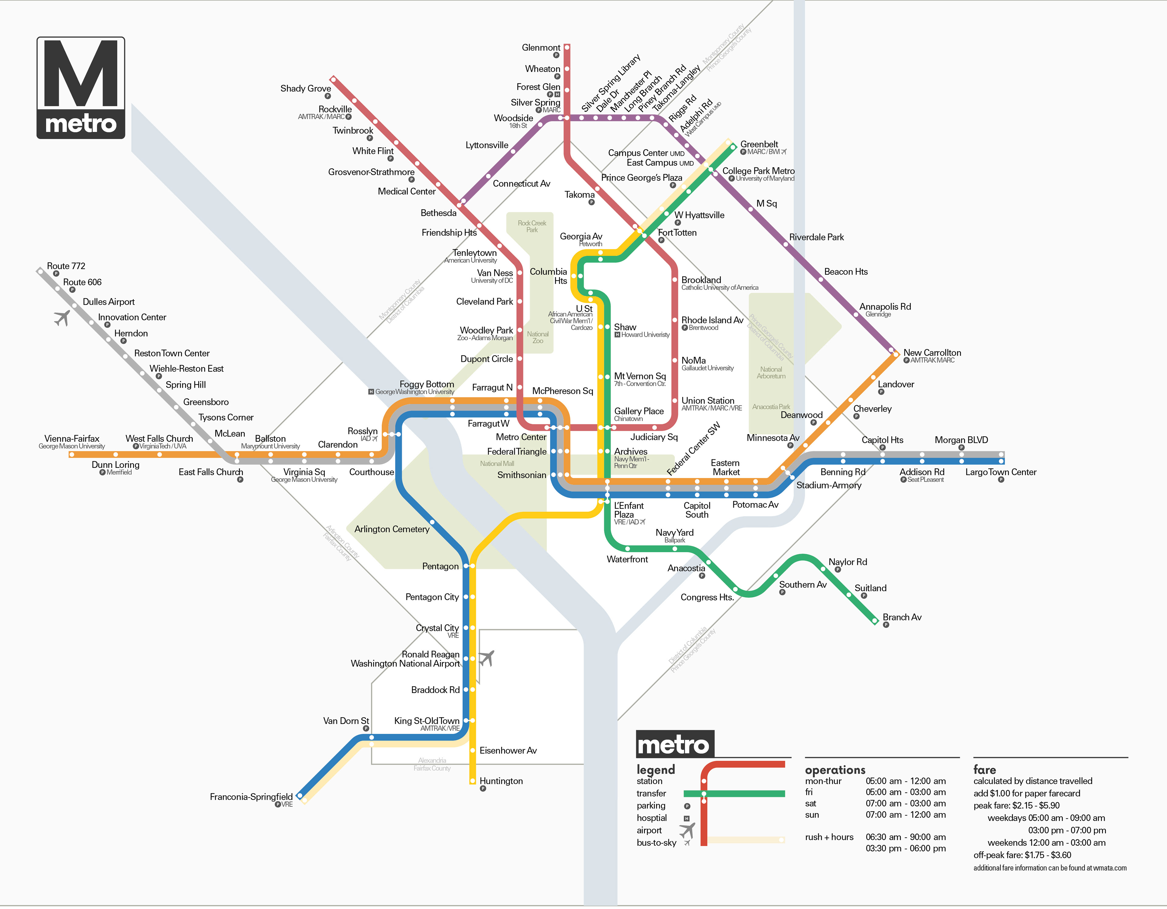
Vignelli-Inspired WMATA Diagram
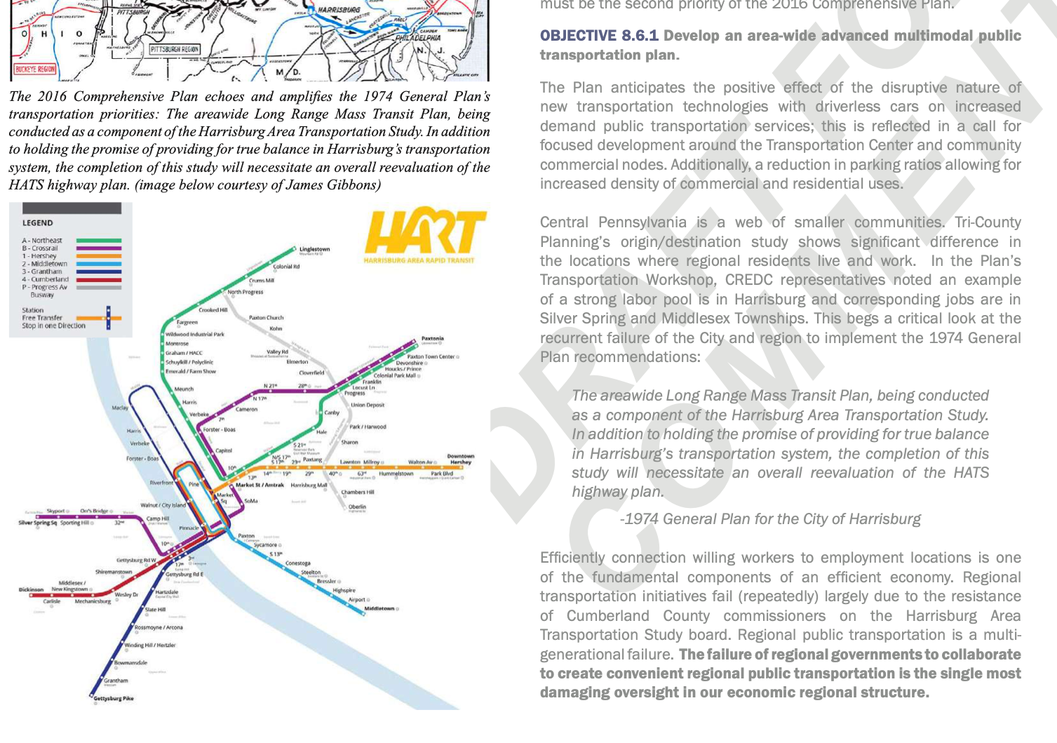
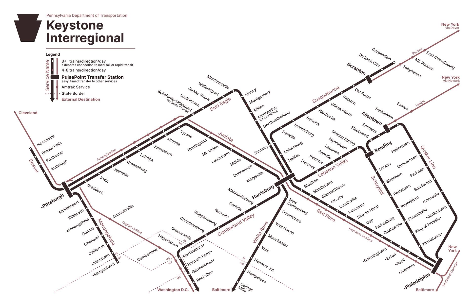
Imagined Regional Rail Systems for Central PA, and the Wider Commonwealth
Below is a concept inspired by 70's design styles imagining what a commonwealth-owned rail system could look like, with close integration with expanded national service.
A more local system concept for Central PA.
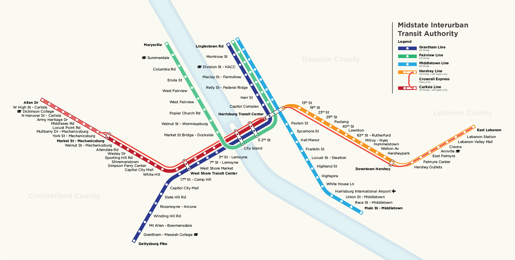
While researching for the above concept, I found that one of my earlier, less-informed versions of this concept was featured in a draft Comprehensive Plan for Harrisburg in 2018. (Courtesy of BeHBG)